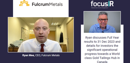
Ryan Mee, CEO of Fulcrum Metals, reviews FY23 and progress on the Gold Tailings Hub in Canada. Watch the video here.
- Home
- Share Prices
- AQSE Share Prices
- Euronext
- Stock Screeners
- Share Chat
- FX
- News & RNS
- Events
- Media
- Trading Brokers
- Finance Tools
- Members
 View Video
Latest Share Chat
- ATM. Since the launch of the Stra...
- CHAR. Hey GP, I share your pain, b...
- LLOY. Boris Johnson is a self serv...
- AET. The clown Terry Bellamy ...
- CGNR. As per announcement of 29 No...
- INDI. These numbers are completely...
- TEK. Https://www.linkedin.com/pos...
- SOLG. Https://www.reuters.com/mark...
- HE1. B1ll, get it right….. I AM...
- Share Prices
- Helium One Share Price
- Helium One Share Chat
 Helium One Share Chat (HE1)
- There are 0 new chat posts. Click here to refresh the page.
 HE1 Share
Price HE1 Share
News0 HE1 Share
Chat86 HE1 Share
Trades276 HE1
HE1
Live RNS0 HE1 Share
Charts HE1 Level 2
Console HE1 Live
Share Price HE1 Broker
Ratings0 HE1 Directors
Deals0 HE1 Financial
Diary HE1
HE1
Fundamentals HE1 Short
Positions0 HE1
HE1
Media0
Share Price Information for Helium One (HE1)
Watchlists are a member only feature
Login to your account
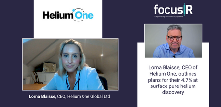
Don't have an account? Click here to register.Latest Helium One Video
Other Videos You Might Like

Share Discussion for Helium One
- You must be logged in to use filters Click here to login
Post a Message
- You must be logged in to post Click here to login
London South East prides itself on its community spirit, and in order to keep the chat section problem free, we ask all members to follow these simple rules. In these rules, we refer to ourselves as "we", "us", "our". The user of the website is referred to as "you" and "your".
By posting on our share chat boards you are agreeing to the following:
- You will only have one login account. Registering with multiple accounts is not allowed. Any user found to have more than one account on this site will have all, and any future accounts suspended permanently.
- Your email and password must only be used by you. If a post is made under your account, it will be considered that it was posted by yourself.
- Your account nickname must not be the same, or contain, listed company names or board members' names.
- While debating and discussion is fine, we will not tolerate; rudeness, swearing, insulting posts, personal attacks, or posts which are invasive of another's privacy.
- You will not;
- discuss illegal or criminal activities.
- post any confidential or price sensitive information or that is not public knowledge.
- post misleading or false statements regarding the share price and performance. Such posts are deemed as market abuse, and may be reported to the appropriate authorities.
- post any private communication, or part thereof, from any other person, including from a member of the board of directors of a listed company. Such posts cannot be verified as true and could be deemed to be misleading.
- post any personal details (e.g. email address or phone number).
- post live price or level 2 updates.
- publish content that is not your original work, or infringes the copyright or other rights of any third party.
- post non-constructive, meaningless, one word (or short) non-sense posts.
- post links to, or otherwise publish any content containing any form of advertising, promotion for goods and services, spam, or other unsolicited communication.
- post any affiliate or referral links, or post anything asking for a referral.
- post or otherwise publish any content unrelated to the board or the board's topic.
- re-post premium share chat posts on regular share chat.
- restrict or inhibit any other user from using the boards.
- impersonate any person or entity, including any of our employees or representatives.
- post or transmit any content that contains software viruses, files or code designed to interrupt, destroy or limit the functionality of this website or any computer software or equipment.
- If you are going to post non-English, please also post an English translation of your post.
- If you are going to post non-English, please also post an English translation of your post.
The IP address of all posts is recorded to aid in enforcing these conditions. As a user you agree to any information you have entered being stored in a database. You agree that we have the right to remove, edit, move or close any topic or board at any time should we see fit. You agree that we have the right to remove any post without notice. You agree that we have the right to suspend your account without notice.
Please note some users may not behave properly and may post content that is misleading, untrue or offensive.
It is not possible for us to fully monitor all content all of the time but where we have actually received notice of any content that is potentially misleading, untrue, offensive, unlawful, infringes third party rights or is potentially in breach of these terms and conditions, then we will review such content, decide whether to remove it from this website and act accordingly.
Premium and Verified Members
![]() Premium Members are members that have a premium subscription with London South East. You can subscribe here.
Premium Members are members that have a premium subscription with London South East. You can subscribe here.
London South East does not endorse such members, and posts should not be construed as advice and represent the opinions of the authors, not those of London South East Ltd, or its affiliates.
I sold half last week and invested, here.
Helium 1 does not have the money to drill 10 wells let alone 100 or 1000.
I bet the company that drilled the first few north sea wells (or the companies that drilled the first 100) did not do that well.
Still I am betting on a helium discovery in these first 4 wells. Why not? Worth a flier. Story is so interesting that it is worth paying for a seat to watch it all play out during the next 6 months - with more interest because of skin in the game.
Harpmandoodle, in fact, I would suggest they change the name from RockHopper to RockBottom?
Harpmandoodle: "Did you know they sank 1000+ holes before North Sea gave up oil"?
Are you talking about your Rockhopper share price? The way RHK sp is going down since 2013 you will soon reach China!
Your spelling is poor.
Did you know they sank 1000+ holes before North Sea gave up oil?
Harpmandoddle
You’re unknown, get the feck off this HE1 board.
Nothing personal, have a nice day.
Roared, I hope Tai roars, sounds a good name for a tiger..
I have a tip that Hawii has plenty of Helium for the taking, it was in that Rift video you posted
@ Noob, Friday was manic,
I watched some of STs favorite TA, all the videos were guys trading the downward trend, real eye opener.
And of course as some have already posted delays will see dips.
I watched like a rabbit in a cars headlights..
Rescued the day with another walk, extra long ;)
Hope there are not too many errors as its all learning for me, time to get some beers I think.
Dai: "I guess heritage oil found those traps were full of useless nitrogen, and few other gases, and moved on ;)"
From: https://repository.arizona.edu/bitstream/handle/10150/629953/ofr_03_05.pdf?sequence=1&isAllowed=y
"Kipling Petroleum Company discovered helium on Pinta Dome in 1950 when it drilled the #1 Macie in search of oil. No oil was found but a large flow of gas was encountered in the Coconino Sandstone. The gas did not burn so it was abandoned to flow
unrestricted from the weB bore for about eight weeks (Dean, 1960, p. 33; Dean and Lauth, 1961, p. 195). Contemporaneous reports indicated that the gas escaping from the open weB "roared like a jet engine" at an estimated initial rate of 24 million cubic feet per day (Heindl, 1952, p. 1331; Beaumont, 1959, p. 160). The operator shut the weB in after testing by the U.S. Bureau of Mines (USBM) showed that the gas was rich in helium (Masters, 1960, p. 30)".
I guess Heritage weren't the first one, Dai!
ST
Mitchells been in Tanzania already
2015
TANZANIA: Mitchell Drilling Tanzania commences operations for Acacia Mining at Bulyanhulu, Tanzania.
https://www.mitchelldrillinginternational.com/about/history
Found this article Ruwka Rifts, Heritage Oil
https://www.geoexpro.com/articles/2015/01/western-tanzania-the-lake-rukwa-and-lake-nyasa-rifts
Wire-line Nuclear Magnetic Resonance Scanner(Neutron thingy)
https://www.slb.com/reservoir-characterization/surface-and-downhole-logging/wireline-openhole-logging/mr-scanner
They struck it lucky, no doubt about that..hopefully we are going to feel that luck..
Mind is drained after all the reading, could never do a full day in school..
Watching the interview and Reading the comments from everybody today...especially ST, micktrick
I have had a best guess at Noobs points, feel free to correct..
So seals for the oil, gives evidence for seals for helium?
I guess so as they use the same methods and technology to find them, and similar descriptions to describe them.
A seal is a seal is a seal?
There are different grades of seals, including clay, shale, salt, grade A being the salt horizons at the other fields..
But I found Bentonite clay which DM mentioned is used for CO2 gas capture, and an effective barrier to Nitrogen.
Nitrogen is our carrier gas for Helium, so I assume if the Nitrogen is trapped so is the Helium, but I need to look that up.
Faults can be seals and also migration paths, I think thats a risk here
Shallow drilling, how long does it take to get there, anyone have knowledge or opinion for :
I guess its a month to setup site, spud, drill 100-150/m(micks comments),carry out tests, and activities for vacating site, and leaving it ready for appraisals
I believe max depth is 1200, so maybe 10 -12 days drilling,
1. gas in muds?
DM said this was real time sampling of mud cuttings
2 . Discovered reservoir.,
looks like there two targets at Tai, I dont know if they would stop if the upper target was a hit, I guess they would, anybody?
From hitting the ground, if it's three RNS it will come pretty quickly together?
Looks like there could be more, Total Depth and I guess spud, maybe party invitations
Blimey, thats a fair bit of digging @ MrSpaceTomato. Thankyou . Looks like Heritage still have licences for South Rukwa area. They're not PLC anymore - were bought out by Qataris ? Lots of money there - wonder if there's been any interaction between the two co's ?
Be interesting to know who the drilling contractor was. Mitchell Drilling have been in Tanzania for diamond exploration in the past. Maybe there's a connection to Mitchell Drilling taking this on with the option of shares in He1
I doubt anybody is going to look at this, but you never know..Galula well cross-section
https://www.researchgate.net/figure/Schematic-seismic-section-through-the-Rukwa-Rift-Basin-in-the-vicinity-of-the-Galula-1_fig10_272152069
@ST DM mentioned neutrons for measurement, The NMR tool, saying they needed to adjust the tool and their mind set as helium absorbs the neutrons differently from hydrocarbons, using it to detect water or gas in rock pores..
Renergen's methane turned out to be helium rich.:)
Sure I read that close to the volcanic activity CO2 is the main gas produced and not so good for helium, but as you move further away things improve and Rukwa is the sweet spot.
Fingers crossed this active rift is going to be the first commercially viable one, and those faults are not too leaky..
I guess heritage oil found those traps were full of useless nitrogen, and few other gases, and moved on ;)
Oh, and you should expect to get one RNS after spud when the drill has reached TD (Total Depth.)
Mick
Hi Noob,
On average about 100m/day, although the fastest rigs/drilling teams can do 150m/day. Also factor in mobilisation and set up time. That's true in oil and gas anyway if you are using a standard set up.
Mick
...Ivuna.1 well
No hydrocarbon were detected in this well
Shale volume calculated in all zones ranged from 33.33% - 38.18%
Average porosity ranged from 1.34% - 11.26%
Permeability ranged from 0.00277mD – 2.8041mD
Sequence of the Lake Beds from GR log seems to be good since the sand observed in all zones were in between shale?s which can act as source rock and seal of the reservoir to prevent HC seepage if at all existed.
Lithology interpretation based on GR log, the study identified sand layers in zone A with promising porosity compared to zone B & C however permeability is low.
The results and interpretations of logs of both Ivuna.1 & Galula.1 wells shows that Lake Beds delineated are less porous so if at all the hydrocarbon will be allocated in this formation, then the formation will be the gas-bearing zones, According to theory formations containing gas has low porosity compare to those with oil. Gas usually has a considerably lower hydrogen concentration which varies with temperature and pressure.
The results and interpretations of logs of both Ivuna.1 & Galula.1 wells shows that Lake Beds delineated are less porous so if at all the hydrocarbon will be allocated in this formation, then the formation will be the gas-bearing zones, According to theory formations containing gas has low porosity compare to those with oil. Gas usually has a considerably lower hydrogen concentration which varies with temperature and pressure.
Therefore when gas is present within the investigation zone of the borehole, the neutron log and formation density logs will read low porosity.
Neutron logs are used principally for delineation of porous formation and determination of their porosity. They respond primarily to the amount of hydrocarbon in the formation. Thus, in clean formation whose pores are filled with water or oil, the neutron log reflects the amount of liquid-filled porosity. Gas zones can often be identified by comparing the neutron log with another porosity log or a core analysis. A combination of the neutron log with one or more porosity logs yield even more accurate porosity values and lithology identification-even an evaluation of shale content. Apparent neutron and density porosities of a zone, effects of dolomite and quartz tend to cancel out.
The end
In my books...it looks all systems go!!!
ST
The main petrophysical properties are porosity, permeability, saturation and capillarity. Porosity determines the storage capacity for hydrocarbons and permeability determines the fluid flow capacity of the rock. Saturation is the fraction of the porosity that is occupied, by hydrocarbons or by water. Finally, capillarity determines how much of the available hydrocarbons can be produced. Accurate determinations of these petrophysical properties are essential to assess the economic viability of the development of reservoirs.
Understanding of lithologies, sequence and thickness of different strata of the Lake Beds is of great significance in evaluating the petroleum system in the Lake Beds succession that is source rock and reservoir rock. This may also help to establish if the reservoir rock exists is well covered by an impermeable seal, or cap rock that would reduce chances of reservoir fluids escaping.
Log data. Based on the wells reports Ivuna.1 and galula.1 were under Amoco Company and drilling contractor was Peter Bawden Driling Kenya Ltd.
Methodology
This Part deals with a variety of concepts necessary for achieving the specific objectives of the study which were: (i) To characterize the sediments of Lake Beds based on petrophysical logs. (ii) To establish potential reservoir zone based on petrophysical properties. Therefore log analysis was adopted and its components are presented, along with step-by-step procedures. Selection of analysis parameters and basic mathematics for this study are also presented.
Characteristics of the Lake Bed sediments based on petrophysical logs
Galula.1 well This objective of the study was achieved though there were limited data to give detailed results in lithological interpretation but the data present were used and the description made based on GR and sonic logs, the Lake Beds are recognized in (0- 950) m and the baseline was set to be 75API where below that it is recognized to be sandstones and above that is shale. Sonic also used to identify rocks using known standard value of slowness in different sedimentary rocks.
Ivuna.1 well At Ivuna.1 the data were available for the range of study from (295-700) m where density and neutron data in in the shallow depth of this well were acting in uncommon way and do not give trusted information, for that case the interpretation were based on GR and Caliper log present. The baseline was set to be 75API where below that it is recognized to be sandstones and above that is shale.
Continue..
Jam, I found the drill petrophysical assessment of the drill in Rukwa as I wanted to get first hand account to subsurface traps and seals..I have just compiled some summary notes for my files.
@S Tomato - I read that stuff from Heritage Oil as well. Was it 2016 / 2017 ? In the end tho they didn't drill and I never found out a reason why. I think they actually wanted to drill into lake Rukwa bed from water staged rig ?
HELIUM MIGRATION FROM THE BASEMENT
Helium generated in the deep crust must migrate to the shallow subsurface to charge traps and mix with hydrocarbon gases. There are three possible mechanisms:
• Diffusion. Widely accepted to be ineffective due to long distances due to km-scale migration distances.
• Bulk fluid flow. Two possible fluids: melt and water. Not effective in cratonic areas due to absence of melt and
water flow from crust and dehydrated nature of deep crust.
• Two-phase flow. Buoyancy drives flow of low density fluid in pore spaces. This is the most likely mechanism for flow from the deep crust. Requires formation of a fluid less dense than water, such as gas or CO2 . Such a fluid forms where their fugacities sum to the total pressure. Results for such models are shown at right for low temperature gradients characteristic of cratons.
Two conditions are modeled:
(1) helium, steam, and CO2 re the only volatile species, and (2) some unknown gas species is available such that helium fugacity has to be only 10% of the total pressure to form a gas phase (unlikely but optimistic). The vertical axis is the time needed to generate sufficient helium to saturate water in a rock with 0.01% porosity, and the horizontal axis is the depth. Model 1 requires time greater than the age of the earth to form a gas phase at 1 km or deeper by helium generation. Model 2 requires helium generation for about 2.5 billion years to form a gas phase at depths greater than 10 km. This is older than the age of the basement in the midcontinent. In other words, a helium-rich gas phase cannot form in the deeper crust in the stable craton.
Helium cannot migrate to shallow depths in a gas phase.
Helium can migrate to the surface from the deep crust and mantle in magmas and immiscible CO2 -rich fluid where heat flow is high. Both require the high heatflow typical of continental margins and active rifts. These transfer mechanisms appear to be ineffective for forming economic high helium gases, because no economic high helium gas accumulation has been found in arc systems or in active rift systems.
Helium exploration requires the same skills and data as conventional petroleum exploration: evaluation of source, migration,
and trapping. However, sources are different, and interaction with water is much more important. Here are some general guidelines for helium exploration:
• Explore in old sediment with old pore waters. Use He/N2 and lithology (GR logs) as a guide to the helium generation potential.
• Explore for relatively shallow traps. He partitions into gas better at shallow depth, higher salinity pore water, and cooler
temperatures.
• High grade prospects with long fetch areas, because long migration maximizes gas exposure to helium-bearing water.
• Avoid central parts of supercharged petroleum systems because helium will be too diluted by methane charge. Explore along the edges of these systems or in reservoirs bypassed by most migration.
Too many known unknowns and unknown unknowns in this game.