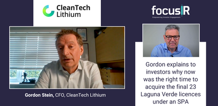
Gordon Stein, CFO of CleanTech Lithium, explains why CTL acquired the 23 Laguna Verde licenses. Watch the video here.
- Home
- Share Prices
- AQSE Share Prices
- Euronext
- Stock Screeners
- Share Chat
- FX
- News & RNS
- Events
- Media
- Trading Brokers
- Finance Tools
- Members
 View Video
Latest Share Chat
- AVCT. I bow to your superior knowl...
- SDY. Re-reading the RNS trading u...
- CNSL. Lazy - the cash improved in ...
- CGNR. Conroy Gold were at PDAC. De...
- COPL. RBM Was anything...
- THG. Much stronger and larger bus...
- EST. If we assume that we discou...
- VAST. Don't you mean 'he was the f...
- UJO. This is very interesting! ...
- JAY. RNS 20 December 2023: "In d...
- Share Prices
- Greatland Gold Share Price
- Greatland Gold Share Chat
 Greatland Gold Share Chat (GGP)
- There are 0 new chat posts. Click here to refresh the page.
 GGP Share
Price GGP Share
News0 GGP Share
Chat54 GGP Share
Trades271 GGP
GGP
Live RNS0 GGP Share
Charts GGP Level 2
Console GGP Live
Share Price GGP Broker
Ratings0 GGP Directors
Deals0 GGP Financial
Diary GGP
GGP
Fundamentals GGP Short
Positions1 GGP
GGP
Media0
Share Price Information for Greatland Gold (GGP)
Watchlists are a member only feature
Login to your account
Don't have an account? Click here to register.Latest Greatland Gold Video
Other Videos You Might Like
Share Discussion for Greatland Gold
- You must be logged in to use filters Click here to login
Post a Message
- You must be logged in to post Click here to login
London South East prides itself on its community spirit, and in order to keep the chat section problem free, we ask all members to follow these simple rules. In these rules, we refer to ourselves as "we", "us", "our". The user of the website is referred to as "you" and "your".
By posting on our share chat boards you are agreeing to the following:
- You will only have one login account. Registering with multiple accounts is not allowed. Any user found to have more than one account on this site will have all, and any future accounts suspended permanently.
- Your email and password must only be used by you. If a post is made under your account, it will be considered that it was posted by yourself.
- Your account nickname must not be the same, or contain, listed company names or board members' names.
- While debating and discussion is fine, we will not tolerate; rudeness, swearing, insulting posts, personal attacks, or posts which are invasive of another's privacy.
- You will not;
- discuss illegal or criminal activities.
- post any confidential or price sensitive information or that is not public knowledge.
- post misleading or false statements regarding the share price and performance. Such posts are deemed as market abuse, and may be reported to the appropriate authorities.
- post any private communication, or part thereof, from any other person, including from a member of the board of directors of a listed company. Such posts cannot be verified as true and could be deemed to be misleading.
- post any personal details (e.g. email address or phone number).
- post live price or level 2 updates.
- publish content that is not your original work, or infringes the copyright or other rights of any third party.
- post non-constructive, meaningless, one word (or short) non-sense posts.
- post links to, or otherwise publish any content containing any form of advertising, promotion for goods and services, spam, or other unsolicited communication.
- post any affiliate or referral links, or post anything asking for a referral.
- post or otherwise publish any content unrelated to the board or the board's topic.
- re-post premium share chat posts on regular share chat.
- restrict or inhibit any other user from using the boards.
- impersonate any person or entity, including any of our employees or representatives.
- post or transmit any content that contains software viruses, files or code designed to interrupt, destroy or limit the functionality of this website or any computer software or equipment.
- If you are going to post non-English, please also post an English translation of your post.
- If you are going to post non-English, please also post an English translation of your post.
The IP address of all posts is recorded to aid in enforcing these conditions. As a user you agree to any information you have entered being stored in a database. You agree that we have the right to remove, edit, move or close any topic or board at any time should we see fit. You agree that we have the right to remove any post without notice. You agree that we have the right to suspend your account without notice.
Please note some users may not behave properly and may post content that is misleading, untrue or offensive.
It is not possible for us to fully monitor all content all of the time but where we have actually received notice of any content that is potentially misleading, untrue, offensive, unlawful, infringes third party rights or is potentially in breach of these terms and conditions, then we will review such content, decide whether to remove it from this website and act accordingly.
Premium and Verified Members
![]() Premium Members are members that have a premium subscription with London South East. You can subscribe here.
Premium Members are members that have a premium subscription with London South East. You can subscribe here.
London South East does not endorse such members, and posts should not be construed as advice and represent the opinions of the authors, not those of London South East Ltd, or its affiliates.
@All with an interest in The Leg of a Dog
The odd loop is within the "development envelope" and looks to be deliberately taking in a sliver of Story Hill, Breakaway. Looking at Sentinel this area looks to be a high ridge of something solid as you can see multiple drainage patterns from the centre of the east-west aligned ridge heading north-east or south-west. When rain falls on much of the sand in the district it looks like it soaks in and starts forming pools of standing water. So this looks quite different.
Looking at the rough location, half way between HAV and Telfer, I'm going speculate wildly (applying my engineering background - electronics) that this is a borrow pit where they are going to get all their more solid chunky bits of aggregate for road building / repairs. If you look at all the other parts of the route it crosses, sand plain or salt pan, both surfaces where any road will literally blow away it'll be hard to keep in good condition for heavy trucks.
Alternate theory would be that they are setting aside a chunk of high ground with a lovely view to the sunny north, away from flood risks, to build nests for a future night parrot colony in rocky outcrops. This is eco friendly mitigation for giving a couple of greater bilbys the hump and making a northern marsupial homeless with our road routing.
Sorry to butt in Sprout, but absolutely every penny of it!! If ever there was a case of buying money this would be it mate. I wish!!!
Bamps, I am a follower of your great and very knowledgeable post’s. A serious question, If you had £50.000 to invest right now, how much of it would you invest in GGP ?
There is a dog leg in the road which was an admendment to an original plan where the road was straight.
It’s been dog legged due to a live Bilby burrow :))
The dog legs in the satellite images were discussed on Twitter. I don't think there was a certain answer but I thought they were where the grader had been turned out of the road to help with drainage or get rid of excess material.
Q
I have DM'd you.
Strudel on the main East-west plain There is a little leg sticking out of the south side of the road
@BottleR, which dog leg do you mean?
@Bamps
What a relief. I can still admire that persistent drill pad south-west of Lake Havieron knowing it is adding knowledge of things at depth. And ain't infrastructure works!
Warrantina rock chips
“the two targets areas of Forester and Warrentinna.
results include:
Soil sampling returned highs of 666.5ppb and 1,308ppb Au.
Rock chip samples returned highs of 44.6g/t, and 464g/t Au.
Confirming the historic reports of the high-grade nature of mineralisation in the area.
The sampling extrapolates mineralised strike lengths of up to 6km in both areas with other areas of the tenement yet to be fully evaluated.”
Saddle Reefs
· A total of 28 rock chip samples were collected at Saddle Reefs and 11 of these samples returned gold values over 10g/t gold;
· High grade gold results include 81.7g/t, 45.7g/t, 37.6g/t, 33.9g/t, 28.2g/t, 23.5g/t, 19.6g/t, 17.5g/t, 14.1g/t, 13.0g/t and 12.4g/t;
· Many rock chip results returned high silver values (up to 106.1g/t silver);
· Importantly, these results roughly quadruple the strike length of gold mineralization identified at surface from 200 metres to approximately 800 metres.
Many also showed high silver including 106.1g/t, 89.0g/t, 38.2g/t, 28.2g/t, 20.4g/t, 14.9g/t, 14.6g/t, 13.88g/t, 13.0g/t, 12.8g/t, 11.3g/t 10.9g/t and 10.4g/t.
A27 where they’re about to start drilling
“At the Eastern prospect a linear zone of gold mineralised stratigraphy is apparent over a strike of approximately 4km. Historical surface rock chip results include 1.9g/t gold, 1.2g/t gold and 1.0g/t gold. Broad spaced drilling along the zone has returned results including 1m at 10.0g/t gold from 16m (CBH138), 1m a 4.93g/t from 12m (CBH071) and 1m at 3.12g/t from 37m (NBH004). The mineralisation appears to track along a structural contact and the focus will be on identifying the higher grade mineralisation along this trend.”
Rogers and Northern Granites seem to be lower down the priority order
“The other prospects of Rogers and Northern Granites show prospective gold mineralisation at surface with historical rock chip results including 50.2g/t and 10.45g/t at Rogers and 6.9g/t at Northern Granites. Drill testing is limited but results have included 1m at 1.48g/t from 38m (NBH008) at Rogers and 1m at 2.35g/t gold from 5m (CBH253) at Northern Granites.”
https://polaris.brighterir.com/public/greatland_gold/news/rns/story/rgddm0r
https://twitter.com/greatlandgold/status/1009729727949561856
Note to myself: I must remember to ask Shaun Day, at some point, if the famous gold nuggets from Black Hills are still in the company safe...I remember Gervaise Heddle being asked the same some years back now, and I seem to recall that he said that they were, then! At least Newcrest can't claim ownership, as it was before the J/V! All tongue in cheek, of course! TT
I’m gonna say it, I’d love to watch you guys have this chat with images showing what you are taking about, it would really bring it all to life.
It’s great to see the road approvals sorted, one less issue for us to hurdle:
What do you all make of the little dog leg that’s by itself? Storage? Power? Yard?
Hi Strudel
The SE deeps seem to be targeted from the north.
The Eastern Breccia deeps at the east end are coming from the west/southwest.
I’m presuming they are picking these routes to infill other zones on the way down.
The bore holes for the paste plant maybe 2x 150mm dia sleeved for the pump pipes to get down.
I don’t believe these will be started till the mine plans are fixed. RC drilling is ok for 400-600m , 600-800m at a stretch
Thanks Bamps and Strudel.
My eye is also on the route of the infrastructure corridor, but nothing seems to have happened there yet.
Q
@Bamps
Morning,
I sincerely hope I'm not getting over excited about a paste plant hole! When a drill appeared there yonks ago, specially one that is core drilling, I automatically presumed we were probing northern pod and even south east deeps. Would they not just do cheap and cheerful RC drilling for water bore holes? And paste passing holes? Or for the latter do they have to switch to core drilling to get down to the depths where the paste is required.
Hi Strudel
I think they are still testing the Dyke in the north and the Zipa target.
To the south by the infrastructure there’s been a lot of bore holes.
The paste plant is planned for that area by the Lake Havieron some of the drilling could be bore holes for water supply and eventually one or two bore holes to pump paste down
Prof Q
Thanks for the info on the new pads.
A27 on Blackhills hasn’t been drilled before, it’s at the north end of the old Eastern target.
A lot of historical wildcat drills have been drilled all around it. That new pad is on a track near the centre of it.
The 2 near Swan are targeting the conductors mentioned in the last Swan RNS
One conductor plate is to the west of A33 Swan and the other pad is targeting 2 plates east of Pearl A32.
There’s another plate to the east of Swan to keep an eye out for.
3 pads at Havieron to the north of the explosive store still seem to be targeting Zipa and the Dyke area, they haven’t given up yet with Zipa
@ProfQ & Other Satellite Fans
Finally got a chance late yesterday to get to Sentinel. Blackhills was as discussed.
I had a look at HAV. I noted the pad south and a little west of Lake Havieron continues to be occupied - it has been for weeks.
South of the dune we now have no rigs. This area fell out of favour for weeks at a time previously.
Central and Eastern HAV continues to be a field of blotches with no discernible changes in the last fortnight.
.....and then we get to north of the dune, with Paddy's images. I'm never entirely convinced about the pads along the line of the dyke, specially to the northern end of our tenement where the terrain is very mottled.
I also note the neighbour's on the north still on previous pads so obviously drilling deep. They are somewhat "excitable" with photos (not lab results) of cores being released previously to the market - and then later having to admit they found no gold after lab results. I wonder if they have learned their lesson? Their share price has fallen by about a third since their boss bought shares on the open market and gave BottleR an interview - I'm not describing any connection with the latter event; there is a school of thought that says statistically directors lose money more often than not when they buy their own shares.
Lots of stuff to ponder before the next satellite update.....
My feeling is that only when the whole process is complete will anything be announced: "Newcrest have bought the 5% for X."
Q
ProfQ, I think many are excited at news of drilling plans at Black Hills and Scallywag.
Any good results will be brilliant news for GGP, but we must also acknowledge we are looking for a needle in a haystack, and if the drill does not find anything, it gives information to analyse and determine where to look next.
Had05 was stunning and I really do not know if we will see Hav type grades again, but let's keep hoping.
Hi BR, been out of coms for a while just catching up, can you include me on your list please :-)
Well I find it hard to believe that a lot of money has been spent upgrading roads in the Black Hills area, and Paterson Range East for no real reason at all.
They must have found something because they keep revisiting it, only time will tell.